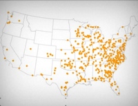
Group quarters data with prison locations now available in Google Earth
Census group quarters data files can now be used to find correctional facilities' locations in Google Earth.
by Leah Sakala, December 14, 2011
I was just working on a research project in which we needed to identify which state legislative districts had prisons in them. The state had released Google Earth files of its district maps, but getting the prison location data in the same format seemed like a tricky task without using expensive and complex GIS software. Luckily we’ve identified a simple solution: plugging the data from our Correctional Facilities Locator 2010 (a national database of correctional facilities counted by the 2010 census) directly into Google Earth.
By adding the relevant state’s Locator 2010 map file as a “Network Link” in Google Earth, I was able to quickly and efficiently pinpoint the locations of all correctional facilities in each state legislative district. Furthermore, each correctional facility entry includes the Census Bureau’s 2010 reported facility population and, when available, the name and type of the facility. Also, for every census block there is a link to detailed demographic information including race and age data for all incarcerated people counted in that block, providing the information necessary for in-depth analyses.
We’ve written up detailed instructions on how you can use this straightforward Google Earth method as well.


