2020 Correctional facility shapefile
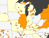
To make the it easier for redistricting professionals and advocates to locate the correctional facilities within legislative districts, the Prison Policy Initiative produced a point shapefile with the correctional population counts for each block in the country.
The shapefile can be accessed here and a description of each field is below. (We also made a similar, much larger, shapefile with all of the group quarters data and a subset of the race and ethnicity data for those blocks.)
- block
- This 4 digit code is the number for each block. (Note that block numbers are only unique within each tract.)
- state
- This is the 2 digit ANSI code (formerly FIPS) for the state.
- county
- This is the 3 digit ANSI code for the county.
- geoid
- This 15 digit code is the ANSI code (formerly FIPS) for each block in the country.
- statename
- This is the name of the state containing that block.
- countyname
- This is the name of the county containing that block.
- totalpop
- This is the number of people in the block, from the PL94-171 file, Table 1.
- gqpop
- Population in group quarters - all, from the PL94-171 file, Table 5
- instpop
- Population in institutionalized group quarters - all, from the PL94-171 file, Table 5
- corrpop
- Population in institutionalized group quarters - correctional facilities, from the PL94-171 file, Table 5
- juvpop
- Population in institutionalized group quarters - juvenile, from the PL94-171 file, Table 5
- nurspop
- Population in institutionalized group quarters - nursing homes, from the PL94-171 file, Table 5
- otherinstp
- Population in other institutionalized group quarters - other, from the PL94-171 file, Table 5
- noninstpop
- Population in non-institutionalized group quarters - all, from the PL94-171 file, Table 5
- collegepop
- Population in non-institutionalized group quarters - college dorms, from the PL94-171 file, Table 5
- militarypo
- Population in non-institutionalized group quarters - military quarters, from the PL94-171 file, Table 5
- othernonin
- Population in non-institutionalized group quarters - other, from the PL94-171 file, Table 5
- lati
- This is the latitude of the centroid of the block.
- longi
- This is the longitude of the centroid of the block.
- URL
- Any block that contains a population counted in a correctional facility includes a URL to that block's entry in the Prison Policy Initiative's database of annotations of facilities. This database is being constantly updated with additional demographic data and facility identifications, and can accept suggestions and corrections from users. To that you can access the most current data, we recommend accessing this database from the web or via HTML PopUps in ArcGIS rather than importing it directly into your local database. We can also accept additional annotations via this link.


